Huuver hybrid flying and riding drone project
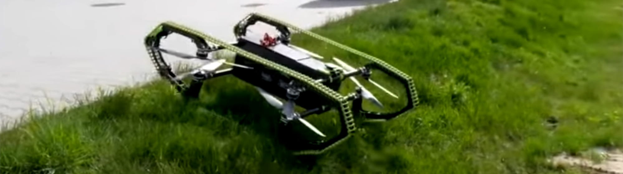
15 February 2022 - HUUVER is a drone that fills lack of current UAV solutions. The construction of a drone connects advantages of both, flying and driving, machines. The drone has the capability of almost all-terrain movements like flying, perching, driving, climbing, vertical take-off and landing. It is constructed to perform professional missions in various, difficult conditions – making it a great tool in search and rescue or patrol missions. The ability of ground-based movements allows HUUVER for reaching the areas unavailable from the air.
The HUUVER drone is the first fully integrated with the Galileo navigation system, profiting from the authentication service and precise navigation solution.
HUUVER is an international project developed by seven entities from five EU member states: Cervi Robotics / Dronehub (Poland), RECTANGLE (Poland), LUT University (Finland), NTT Data Spain (former Everis Aerospace & Defense) (Spain), GINA Software (Czech Republic), BLADESCAPE (Austria) and Brimatech Services (Austria).
The project has received funding from the European Union’s Horizon 2020 research and innovation programme (European GNSS Agency). At the turn of January and February, the project was successfully presented and officially completed.